L’Eroica is a celebration of the classic white roads (Strada Bianchi) of the Chianti area of Tuscany and the cycle races that have historically been held on them. In practice, it is a 3 day festival of historic cycling with various events. The most well known of these is the cycle event held on the first Sunday in October. There are 4 different distances, the full course of 205km, and the shorter 135km, 70km and 35km courses. All courses are a mixture of tarmac and gravel roads.
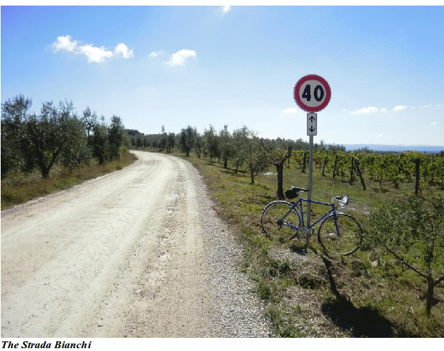 We had arrived in the area a week before the event which gave us the opportunity to check out some of the route and in particular to get some practice riding the unsurfaced roads. Some of the steep uphill and downhill sections would have been real fun on an MTB, on a road bike with 23mm tyres and less than efficient 30yr old brakes they became a real challenge and downright scary at times.
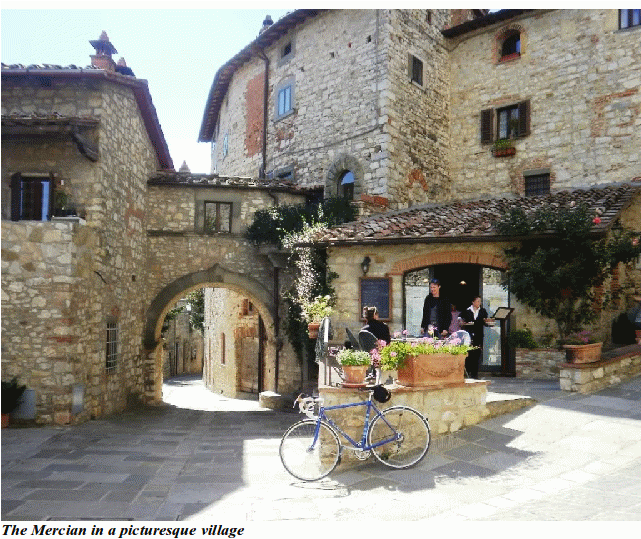
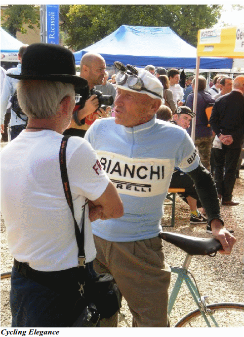
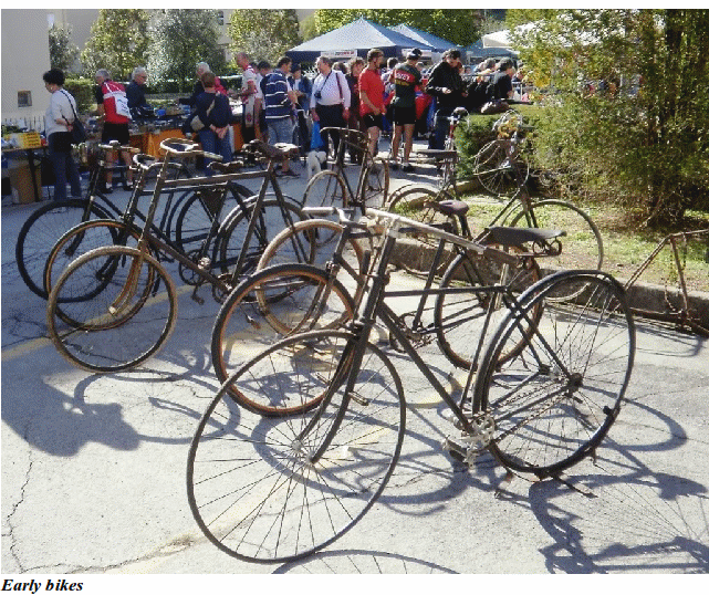
On the Friday we cycled the 25km to the start from our campsite in Siena to register and to investigate the bike jumble. Registration was relatively painless – there were no queues and once we worked out we needed to find our start numbers first, easily managed. We received our goody bags which were a rather nice large musette that included (rather ominously I thought) spare tubes, along with our race numbers, event cards and food voucher. We had a look around the historic bike collection that included everything from the ‘hobby horse’ through some nice Ordinarys, early safety bikes and then a large collection of race bikes from the early 20th Century through to the 60s and 70s.
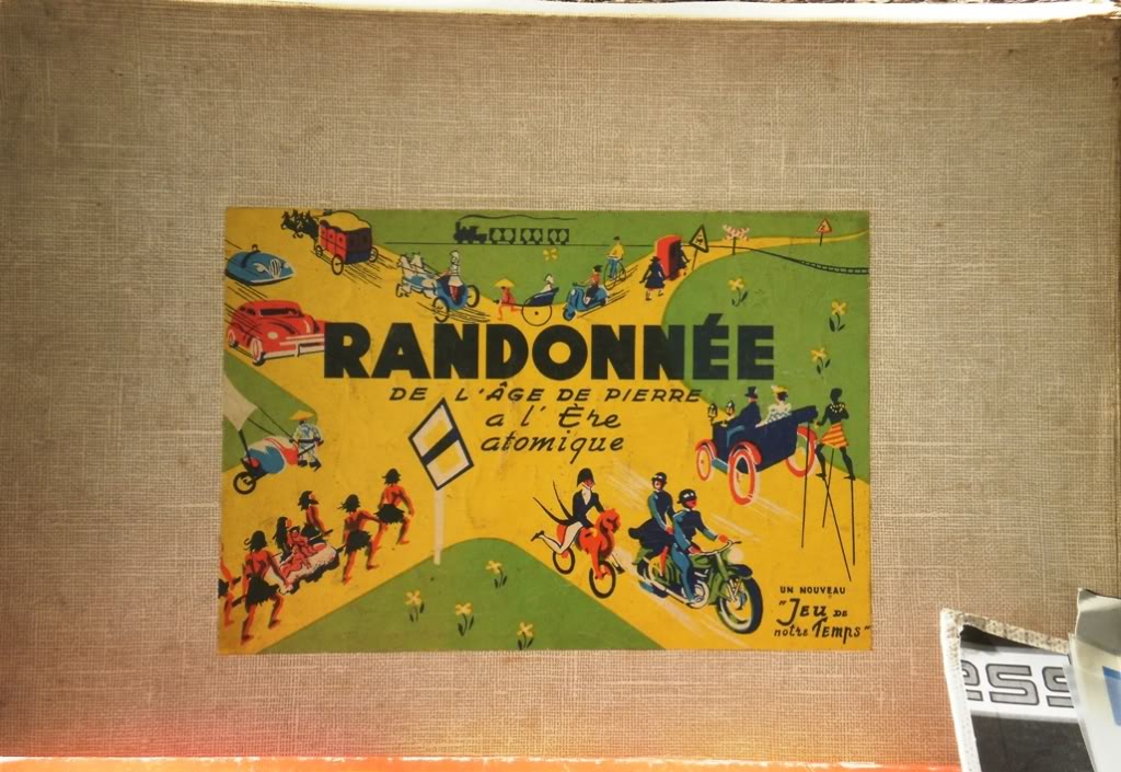
After lunch we had a good look round the bike jumble – there wasn’t much you couldn’t find here in terms of spares. I managed to resist stocking up on spares and avoided some really nice 50s race bikes on sale and we headed for the clothing to get ourselves some retro wool race jerseys to wear on the ride. I came across this board game and nearly gave into the impulse to buy it.
The Event
I had opted for the 135km course, long enough to be a challenge but not so long that it became a slog to get round – I was here for a fun ride. The start time was between 5am and 7am. We spent the night sleeping in the back of the car parked on the outskirts of the town. Around 4.30am other cars were pulling in and the sound of people preparing to ride roused me out of my sleeping bag. At 5.30am I set off for the start, suprisingly there was no queue and I was soon signed on and had my card stamped, then it was away into the dark.
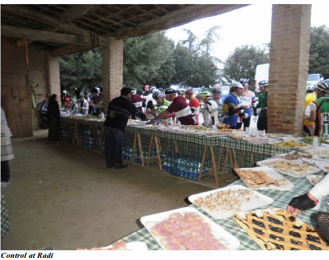
The first section was a gentle 4km downhill and I got on the back of a group of Italian riders making good speed. A left turn off the main road was the start of the first (and longest) climb. People seem to be taking this really slowly and I was passing groups all the way up the road. I spotted a Carradice saddlebag attached to a Brooks saddle and sure enough it was another Brit with whom I passed a few words. At Brolio about 10km into the ride was the first stretch of Strada Bianchi, I had ridden this section a few days before and knew that it started steep and got steeper, the edge of the road had been lit with large candles on both sides and it was a bit surreal to ride. As the road got higher the candles disappeared and I was glad of the mountain bike lighting I had fitted, especially when we reached the top and the road plunged steeply down, it seemed to be giving me a distinct advantage as I was passing loads of riders picking their way down. We were soon back on tarmac and heading fast downhill as the sky began to lighten. By the time we reached the valley and had started to climb the next hill it was fully light. The next 30 or so kilometres to the first control at Radi were alternating sections of Strada Bianchi and tarmac that rolled up and down but nothing too steep. I reached the first control at 47km after just over 2 hours riding, better time than I had expected. The control was brilliant – a huge array of food including many local specialities. I can recommend Panforte as an energy food! There were not too many people so I was fairly quickly through this control and on the road again.
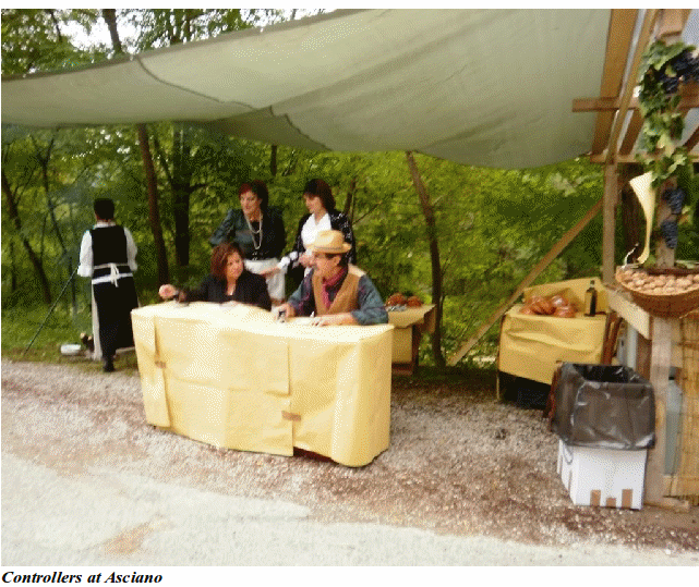
The next section was much flatter and the Strada Bianchi almost as fast as the tarmac including a great 10km section. This was only marred by a large sheepdog that attacked each rider as they passed watched by its unconcerned owner. I was soon at Asciano, the next control at 87km, and only just over 4 hours riding done. Again fantastic food and a great atmosphere with the controller and his helpers all in local traditional costume. Just as I was about to leave it started to rain – just a gentle drizzle, but enough to turn the dust on the next section of unpaved road to a slick layer of mud.
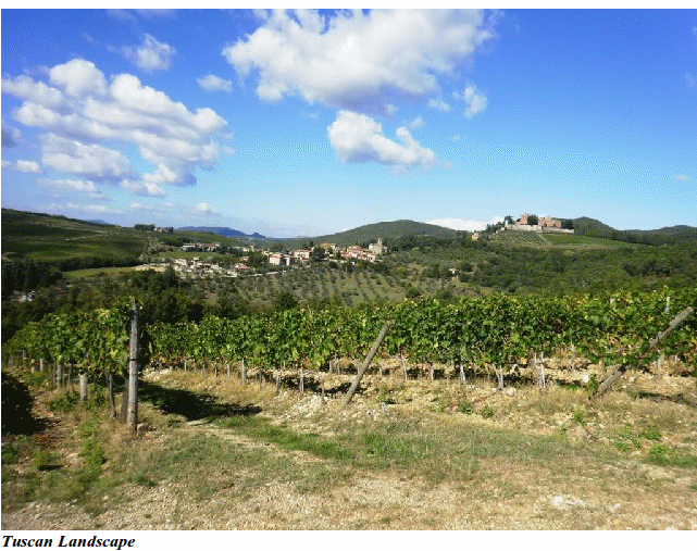
The next 15km of Strada Bianchi were the hardest, most scenic and most exhilarating of the ride. Known as the Crete Senesi the road follows the crest of a ridge up a series of steep climbs and down some steep descents with average gradients of >15%, some of the corners were at least 25% and rutted and loose into the bargain. In places the ridge was only as wide as the road with big drops off the sides but brilliant views across the hills of Tuscany. I was defeated by 2 of the climbs on this section – not being able to ride them seated and the rear wheel spinning out if I got out of the saddle. However, with the continued drizzle it was with some relief that I reached the end of the unpaved road covered in a thin layer of grey mud. A fantastic section of steep, wide, smooth tarmac provided an exhilarating 50mph descent followed by a climb up to my final control at Castelnuovo Berardenga. I was feeling quite hungry at this point and therefore pleased to find a large pan of delicious thick vegetable broth at the control along with the now familiar panforte, dried fruit and selection of cakes and tarts.
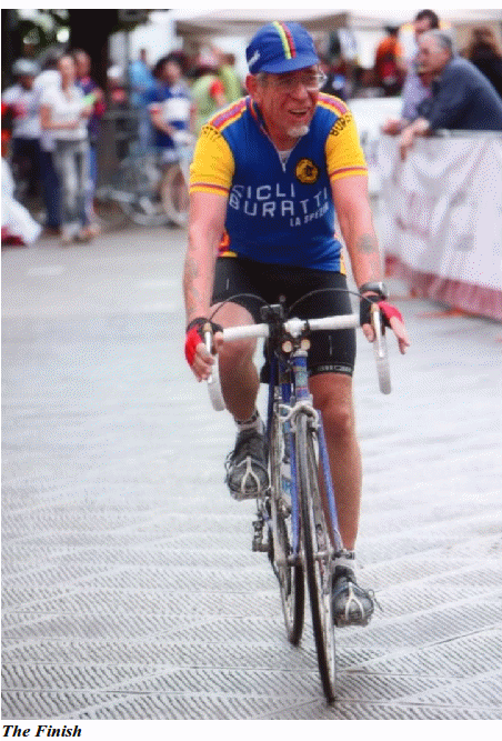
It had taken me an hour and a half to do the 20km from the previous control so my average speed had dropped to where I thought it might be – about 17km/hour. I knew the next section was a 10km descent on tarmac followed by a 10km climb mainly on tarmac but with a steep section of unpaved road at the top followed by a 12km tarmac downhill to the finish, so the average speed would probably improve. By this time I think I had got ahead of most riders on this route as there were few riders at the control and I only saw 2 other riders up until the point when my route merged with the 35km route near the finish. As I thought, this was a relatively easy section and I made good time covering the last 33km in 1hr 20min. The atmosphere at the finish was great with a long finish funnel lined with people applauding. At the finish I received a goody bag of local delicacies including a bottle of special L’Eroica Chianti wine.
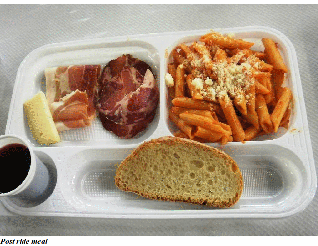
After making a few enquiries we located the venue for the finish meal. This was a real feat of organisation – a meal of pasta, ham, salami and cheese with wine for 3,500 people, and very tasty it was too.
This was a fantastic event that certainly lived up to expectations, the ride itself was worth it but the atmosphere and general ambience really made it special. On reflection I think the full 205km route would have been worth the effort (the general view was this takes 11 – 13hrs to complete), but this just gives me an excuse to go back next year.
The Bike
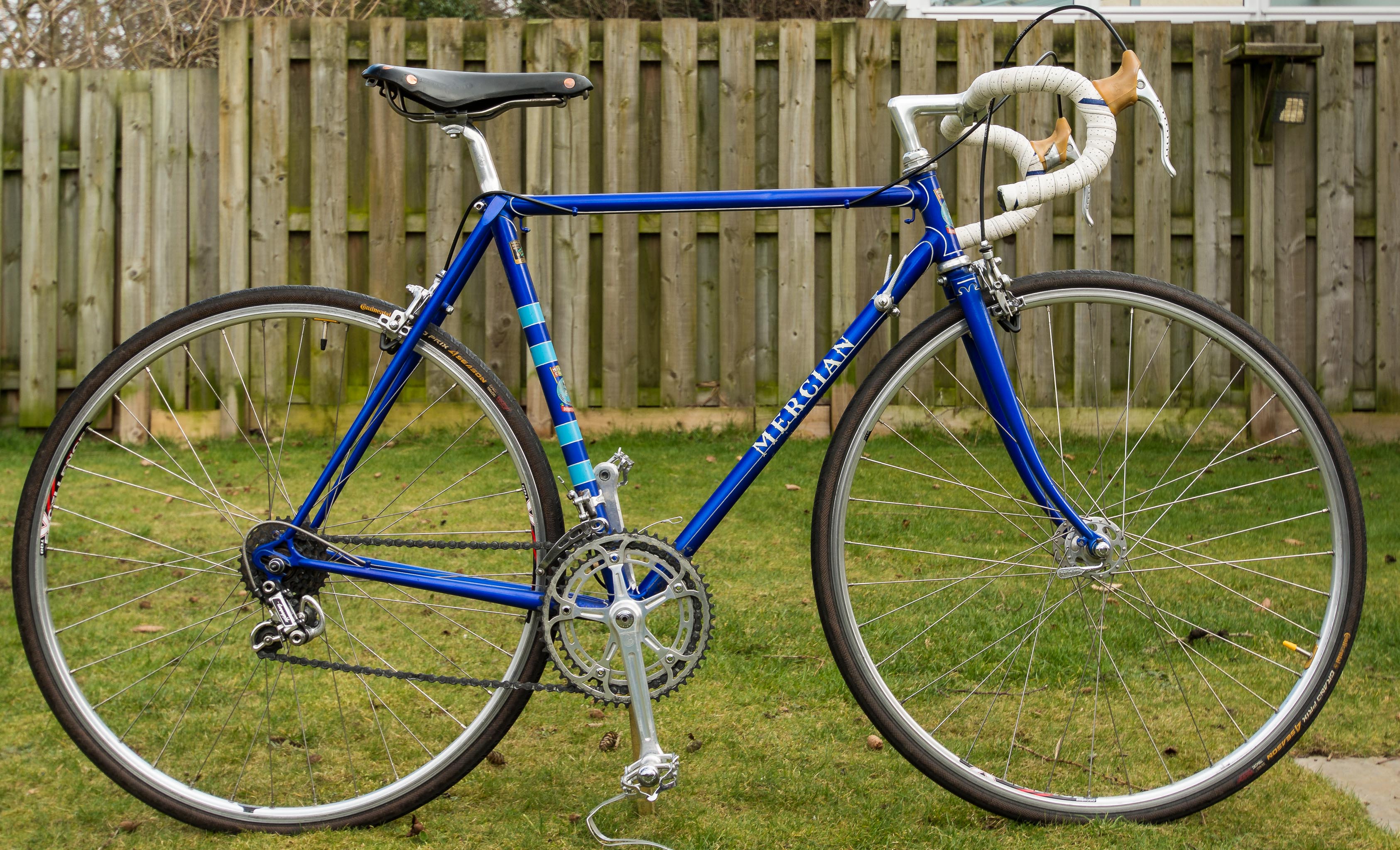
I rode a 1976 Mercian ‘King of Mercia’ with full Campag Super Record groupset. In terms of gearing, I used a 53/42 chainset and 14/28 5 speed rear block. Wheels were vintage Campag SR large flange hubs with Ambrosio Excellence rims built by the renowned Scottish wheel builder, Big Al which ended the event as true as the day they were built. Tyres were Continental 4 Seasons 23mm front 25mm rear.
Some Ride Statistics
Distance: 135.34 km
Moving Time: 06:35:22
Elapsed Time: 07:26:41
Avg Speed: 18.2 km/h
Avg Moving Speed: 20.5 km/h
Elevation Gain: 1,914 m
Min Elevation: 138 m
Max Elevation: 525 m